Jalón Inteligente
In the execution of works, topography is a fundamental part, since it constitutes the base for the geometric definition of any project. In this context, it is highlighted that currently the measurement process of topographic variables involves a highly hand-operated component and the inaccuracy in the placement of the ranging rod translates into significant faults in the recorded measurements. This is why in this project an Intelligent Ranging Rod has been developed, that is to say, a pole capable of automatically identifying its correct leveling and determining its real height to simplify and streamline the measurement of survey points, thus minimizing measuring errors. In addition, given that the BIM work methodology is mandatory in Spain as of 2018 for the implementation of construction projects and at present it is virtually not applied in the integration of the topographical information in the global model of the work, this project also discloses a collaborative work methodology that grants implementing the entire associated information to the global model and coverage of all the course in the executing of topographical works in the construction field.
The final purpose of this equipment is to streamline the measuring of survey points, lessening the human error resulting from taking measurements, which is currently carried out completely manually.
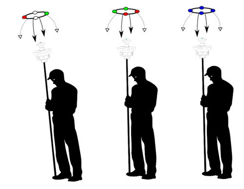
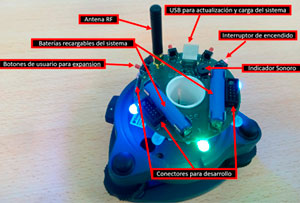
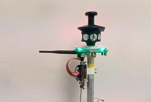
The operation of the ranging rod basically consists in that, when it is level , automatically sends out a signal to the total station and it stores the topographic data that defines the measured point with a high accuracy. The correct leveling of the pole will be an indispensable condition for sending the signal to the total station and the measurement of each individual spot. Regarding the technologies used, its operation is based on a combination of optical and electronic technologies, determined according to its topographic scope and weight, stability and robustness. Additionally, it will be interoperable with the total station and connections will be made from the collection of geometric data (entry and management) to BIM software. Prototype built shown below. Outline presented below:
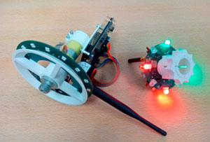
Prototype shown below:
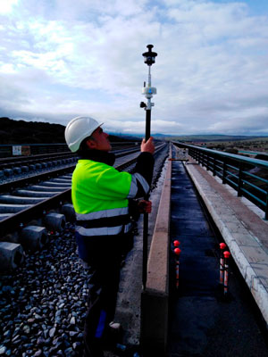
Real example of measurements on site